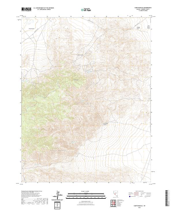
2021 Map of Camp Douglas
USGS Topo · Published 2021About this map
The Excelsior Mountains dominate the southern half of this landscape, rising sharply above the desert floor in Mineral County. This modern survey illustrates a remote corner of Nevada where water sources like Silver Dyke Spring and Moho Spring dictate the historic movement across the basin-and-range terrain. To the north, the topography flattens into Garfield Flat and the western edge of Soda Spring Valley, connected by the winding Garfield Flat Rd. The presence of Silver Dyke Canyon and Rebel Canyon underscores the mining history common to this region, though no active structures are noted here. High peaks such as Thunder Mtn provide a vertical orientation for a landscape defined by seasonal drainages and isolated springs like Pepper Spring and White Rock Spring.
Find a feature on this map
19 named features on this map. Tap any name to fly to it.
Don’t see what you’re looking for? This feature index may not catch every label — zoom into the map to look around manually.
Map Details
Editions of this 2021 Camp Douglas Map
This is the sole edition of this map. No revisions or reprints were ever made.
Other maps of this area

1909 · Hawthorne
USGS Topo · 1:250,000

1911 · Hawthorne
USGS Topo · 1:250,000

1915 · Hawthorne
USGS Topo · 1:250,000

1948 · Walker Lake
USGS Topo · 1:250,000

1957 · Walker Lake
USGS Topo · 1:250,000

1962 · Walker Lake
USGS Topo · 1:250,000

1964 · Walker Lake
USGS Topo · 1:250,000

1967 · Moho Mountain
USGS Topo · 1:24,000
1967 · Candelaria
USGS Topo · 1:24,000

1967 · Mina NW
USGS Topo · 1:24,000