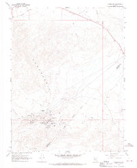
1967 Map of Candelaria
USGS Topo · Published 1969About this map
The high desert mining landscape of the Candelaria Hills is captured here in the late 1960s, centered on the remains of once-booming silver camps. At the foot of Candelaria Mountain, the map identifies Candelaria (Site) and Metallic City (Site), marking the locations of these historical settlements. The terrain is scarred by extensive workings, with Tailings and dozens of individual shafts like the Northern Belle Mine, Argentum Mine, and Mt Diablo Mine clustered around Pickhandle Gulch.
Find a feature on this map
34 named features on this map. Tap any name to fly to it.
Don’t see what you’re looking for? This feature index may not catch every label — zoom into the map to look around manually.
Map Details
Editions of this 1967 Candelaria Map
2 editions found
Other maps of this area

1907 · Tonopah
USGS Topo · 1:250,000

1908 · Tonopah
USGS Topo · 1:250,000

1909 · Hawthorne
USGS Topo · 1:250,000

1911 · Hawthorne
USGS Topo · 1:250,000

1915 · Hawthorne
USGS Topo · 1:250,000

1948 · Walker Lake
USGS Topo · 1:250,000

1956 · Tonopah
USGS Topo · 1:250,000

1957 · Walker Lake
USGS Topo · 1:250,000

1959 · Tonopah
USGS Topo · 1:250,000

1962 · Walker Lake
USGS Topo · 1:250,000