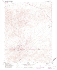
1967 Map of Candelaria
USGS Topo · Published 1982About this map
Candelaria and Metallic City anchor this 1967 study of a high-desert mining district straddling the Mineral and Esmeralda County line. The landscape is defined by its deep silver and gold heritage, with a dense concentration of shafts and workings such as the Northern Belle Mine, Argentum Mine, and Columbus Mine clustered around Pickhandle Gulch. The remnants of the Old Railroad Grade and various Jeep Trails snake through the Candelaria Hills, tracing the infrastructure required to service these remote operations. Family historians will find the Candelaria Cemetery noted on the slopes of Candelaria Mountain, while mineral exploration enthusiasts can trace the locations of the Mt Diablo Mine and Black Metallic Mine. The mapping includes 1982 revisions, showing contemporary features like a Radio Tower and Pipeline alongside the historic mining sites.
Find a feature on this map
25 named features on this map. Tap any name to fly to it.
Don’t see what you’re looking for? This feature index may not catch every label — zoom into the map to look around manually.
Map Details
Editions of this 1967 Candelaria Map
2 editions found
Other maps of this area

1907 · Tonopah
USGS Topo · 1:250,000

1908 · Tonopah
USGS Topo · 1:250,000

1909 · Hawthorne
USGS Topo · 1:250,000

1911 · Hawthorne
USGS Topo · 1:250,000

1915 · Hawthorne
USGS Topo · 1:250,000

1948 · Walker Lake
USGS Topo · 1:250,000

1956 · Tonopah
USGS Topo · 1:250,000

1957 · Walker Lake
USGS Topo · 1:250,000

1959 · Tonopah
USGS Topo · 1:250,000

1962 · Walker Lake
USGS Topo · 1:250,000