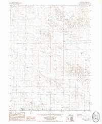
1986 Map of Camp Lake
USGS Topo · Published 1986About this map
The small settlement of Lynn sits at the heart of this mid-1980s survey in Morrill County, Nebraska. This high plains landscape is defined by its intermittent water sources and the undulating topography of the Sandhills. Notable water bodies such as Peterson Lake, Peer Lake, and the eponymous Camp Lake dot the northern portion of the quadrangle, while Reilly Hill and the deep cut of Cedar Canyon dominate the southern reaches. The presence of numerous wells across the terrain suggests a landscape heavily dependent on groundwater management for livestock and ranching. Infrastructure is sparse, marked primarily by a Trans Line and a prominent Radio Tower, reflecting the isolated character of this rural region during the late twentieth century. In the southwest, Plum Creek drains toward the lower elevations, providing a natural contrast to the higher ridges and hills that characterize the rest of the survey area.
Find a feature on this map
11 named features on this map. Tap any name to fly to it.
Don’t see what you’re looking for? This feature index may not catch every label — zoom into the map to look around manually.
Map Details
Editions of this 1986 Camp Lake Map
This is the sole edition of this map. No revisions or reprints were ever made.
Other maps of this area

1896 · Browns Creek
USGS Topo · 1:125,000

1898 · Camp Clarke
USGS Topo · 1:125,000

1899 · Browns Creek
USGS Topo · 1:125,000

1949 · Lynn
USGS Topo · 1:62,500

1954 · Scottsbluff
USGS Topo · 1:250,000

1958 · Scottsbluff
USGS Topo · 1:250,000

1965 · Angora SE
USGS Topo · 1:24,000

1965 · Broadwater NW
USGS Topo · 1:24,000
1965 · Angora NE
USGS Topo · 1:24,000
1965 · Bridgeport
USGS Topo · 1:24,000