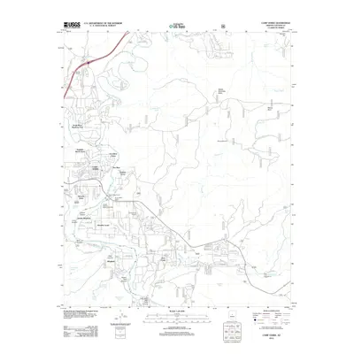
2012 Map of Camp Verde
USGS Topo · Published 2012About this map
Camp Verde occupies the heart of this Yavapai County landscape, situated at the confluence of the Verde River and Beaver Creek. The map details a community defined by its proximity to water and its transit infrastructure, from the Montezuma Airport to the Arizona Highway Maintenance Yard. Residential growth is evident in named subdivisions such as Jordan Meadows, Paradise Acres, and Pioneer Acres, which are interspersed among irrigation features like Woods Ditch.
Find a feature on this map
116 named features on this map. Tap any name to fly to it.
Don’t see what you’re looking for? This feature index may not catch every label — zoom into the map to look around manually.
Map Details
Editions of this 2012 Camp Verde Map
This is the sole edition of this map. No revisions or reprints were ever made.
Other maps of this area

1887 · Verde
USGS Topo · 1:250,000

1892 · Verde
USGS Topo · 1:250,000

1923 · Camp Verde
USGS Topo · 1:125,000

1929 · Turret Peak
USGS Topo · 1:125,000

1932 · Camp Verde
USGS Topo · 1:125,000

1933 · Turret Peak
USGS Topo · 1:125,000

1936 · Camp Verde
USGS Topo · 1:125,000

1954 · Holbrook
USGS Topo · 1:250,000

1957 · Holbrook
USGS Topo · 1:250,000

1958 · Holbrook
USGS Topo · 1:250,000
Featured Places
- Camp Verde, AZ
- Yavapai County, AZ
- United States
- Mesa Verde Estates, Camp Verde
- Verde River Meadows One, Camp Verde