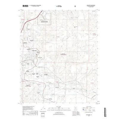
2018 Map of Camp Verde
USGS Topo · Published 2018About this map
Montezuma Castle National Monument and the historic General Crook Trail define this landscape along the Verde River in Yavapai County. The topography is shaped by the transition from the high Wickiup Mesa and Mid Schroeder Butte down into the fertile valley of Camp Verde. This modern survey illustrates the dense concentration of residential developments like Mesa Verde Estates, Fort Verde Estates, and Jordan Meadows that have grown around the river's corridor. Local history is anchored by sites such as the Clear Creek Cem and Fort River Caves, while the regional hydrology is traced through Woods Ditch and numerous tanks including Hat Ranch Tank and Monroe Tank. The map reveals how modern infrastructure, such as the Montezuma Airport, intersects with protected lands in the Coconino National Forest and Prescott National Forest.
Find a feature on this map
99 named features on this map. Tap any name to fly to it.
Don’t see what you’re looking for? This feature index may not catch every label — zoom into the map to look around manually.
Map Details
Editions of this 2018 Camp Verde Map
This is the sole edition of this map. No revisions or reprints were ever made.
Other maps of this area

1887 · Verde
USGS Topo · 1:250,000

1892 · Verde
USGS Topo · 1:250,000

1923 · Camp Verde
USGS Topo · 1:125,000

1929 · Turret Peak
USGS Topo · 1:125,000

1932 · Camp Verde
USGS Topo · 1:125,000

1933 · Turret Peak
USGS Topo · 1:125,000

1936 · Camp Verde
USGS Topo · 1:125,000

1954 · Holbrook
USGS Topo · 1:250,000

1957 · Holbrook
USGS Topo · 1:250,000

1958 · Holbrook
USGS Topo · 1:250,000
Featured Places
- Camp Verde, AZ
- Yavapai County, AZ
- United States
- Mesa Verde Estates, Camp Verde
- Verde River Meadows One, Camp Verde