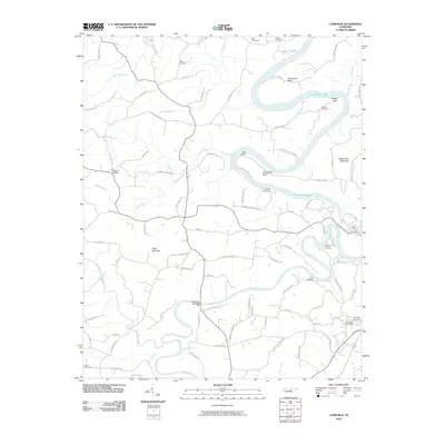
2010 Map of Campaign
USGS Topo · Published 2010About this map
Collins River meanders sharply through this Middle Tennessee landscape, meeting the Caney Fork near the hydroelectric site at Great Falls. This 2010 survey documents a transition from traditional river crossings and small settlements to contemporary recreational use along the shores of Center Hill Lake. Notable historical and genealogical markers are scattered throughout, including family burial grounds like the Walker Cemetery, Bain Cemetery, and White Cemetery. The topography is defined by significant bends in the river such as Greenbrier Bend and Horseshoe Bend, with higher elevations marked by Hickory Nut Mountain and Cope Mountain. The map details the local infrastructure from the Campaign Post Office to Moores College, as well as older river navigation points like the Hennessee Bridge Ford and various docks serving the reservoir.
Find a feature on this map
91 named features on this map. Tap any name to fly to it.
Don’t see what you’re looking for? This feature index may not catch every label — zoom into the map to look around manually.
Map Details
Editions of this 2010 Campaign Map
This is the sole edition of this map. No revisions or reprints were ever made.
Other maps of this area

1893 · Mc Minnville
USGS Topo · 1:125,000

1895 · Mc Minnville
USGS Topo · 1:125,000

1942 · Statesville
USGS Topo · 1:100,000

1943 · Cookeville
USGS Topo · 1:100,000

1943 · Mc Minnville
USGS Topo · 1:100,000

1944 · Cookeville
USGS Topo · 1:100,000

1953 · Chattanooga
USGS Topo · 1:250,000

1953 · Mc Minnville
USGS Topo · 1:24,000
1957 · Cardwell Mountain
USGS Topo · 1:24,000

1957 · Chattanooga
USGS Topo · 1:250,000