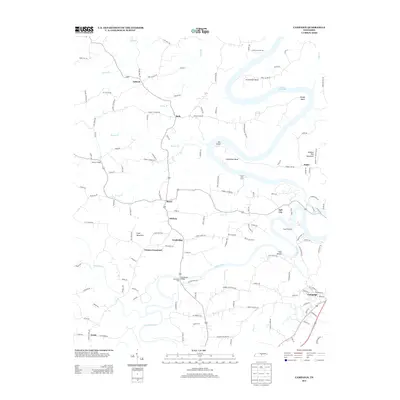
2013 Map of Campaign
USGS Topo · Published 2013About this map
The Collins River carves a winding path through this landscape, creating dramatic geographical features like the sharp meander at Horseshoe Bend and the broad waters of Center Hill Lake to the north. Settlement is concentrated around historical crossroads and small communities such as Campaign, Fall City, and Greens Crossroad. The topography is defined by significant elevations like Hickory Nut Mountain and Cope Mountain, which overlook a network of creek drainages including Barren Cr and Mountain Cr.
Find a feature on this map
139 named features on this map. Tap any name to fly to it.
Don’t see what you’re looking for? This feature index may not catch every label — zoom into the map to look around manually.
Map Details
Editions of this 2013 Campaign Map
This is the sole edition of this map. No revisions or reprints were ever made.
Other maps of this area

1893 · Mc Minnville
USGS Topo · 1:125,000

1895 · Mc Minnville
USGS Topo · 1:125,000

1942 · Statesville
USGS Topo · 1:100,000

1943 · Cookeville
USGS Topo · 1:100,000

1943 · Mc Minnville
USGS Topo · 1:100,000

1944 · Cookeville
USGS Topo · 1:100,000

1953 · Chattanooga
USGS Topo · 1:250,000

1953 · Mc Minnville
USGS Topo · 1:24,000
1957 · Cardwell Mountain
USGS Topo · 1:24,000

1957 · Chattanooga
USGS Topo · 1:250,000