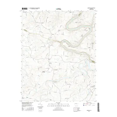
2016 Map of Campaign
USGS Topo · Published 2016About this map
The Collins River and its sinuous tributaries carve through the central Tennessee landscape, marking the convergence of DeKalb, Warren, and White counties. This area is defined by its rural settlement pattern, where small communities like Belk, Berea, and Greens Crossroad are connected by a network of family-named roads such as Alva Jones Rd and Obie Addock Rd. The topography is dominated by the winding path of Center Hill Lake in the north and the expansive Great Falls Lake to the south, with dramatic river features like Horseshoe Bend and Flat Shoals illustrating the region's complex hydrology.
Find a feature on this map
139 named features on this map. Tap any name to fly to it.
Don’t see what you’re looking for? This feature index may not catch every label — zoom into the map to look around manually.
Map Details
Editions of this 2016 Campaign Map
This is the sole edition of this map. No revisions or reprints were ever made.
Other maps of this area

1893 · Mc Minnville
USGS Topo · 1:125,000

1895 · Mc Minnville
USGS Topo · 1:125,000

1942 · Statesville
USGS Topo · 1:100,000

1943 · Cookeville
USGS Topo · 1:100,000

1943 · Mc Minnville
USGS Topo · 1:100,000

1944 · Cookeville
USGS Topo · 1:100,000

1953 · Chattanooga
USGS Topo · 1:250,000

1953 · Mc Minnville
USGS Topo · 1:24,000
1957 · Cardwell Mountain
USGS Topo · 1:24,000

1957 · Chattanooga
USGS Topo · 1:250,000