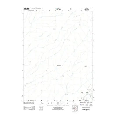
2012 Map of Campbell Mound
USGS Topo · Published 2012About this map
Campbell Mound rises as a central landmark in this portion of Butte County, where the landscape is defined by a series of deep drainages and volcanic ridges. The terrain transitions from the elevations of Keefer Ridge and Cohasset Ridge in the southeast toward the winding courses of Zimmershed Cr and Pine Cr. Evidence of remote habitation and seasonal use appears in the form of Baccala Cabin near Bell Spring and Franks Cabin further south. These sites, along with names like Barn Hollow and Steamboat Point, suggest a history of ranching or early forest management. The intricate network of seasonal and perennial waterways, including the Anderson Fork and W Fork Rock Cr, illustrates the complex hydrology that feeds the larger Sacramento Valley watershed from these foothills. The map provides a look at the rural character of the region as it stood in the early 21st century, prior to significant changes in land management and environmental conditions.
Find a feature on this map
29 named features on this map. Tap any name to fly to it.
Don’t see what you’re looking for? This feature index may not catch every label — zoom into the map to look around manually.
Map Details
Editions of this 2012 Campbell Mound Map
This is the sole edition of this map. No revisions or reprints were ever made.
Other maps of this area

1886 · Lassen Peak
USGS Topo · 1:250,000

1891 · Chico
USGS Topo · 1:125,000

1892 · Lassen Peak
USGS Topo · 1:250,000

1893 · Chico
USGS Topo · 1:125,000

1894 · Lassen Peak
USGS Topo · 1:250,000

1895 · Chico
USGS Topo · 1:125,000

1912 · Nord
USGS Topo · 1:31,680

1912 · Keefers
USGS Topo · 1:31,680

1912 · Singer Creek
USGS Topo · 1:31,680

1935 · Paynes Creek
USGS Topo · 1:96,000