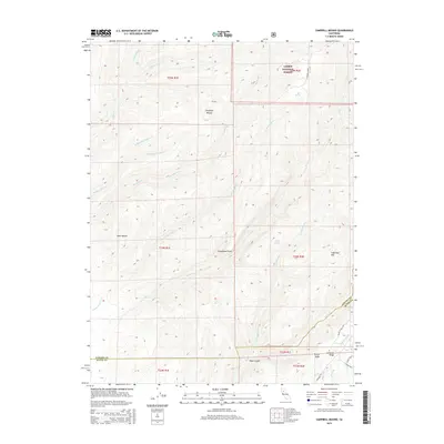
2015 Map of Campbell Mound
USGS Topo · Published 2015About this map
Campbell Mound and the southern reaches of Lassen National Forest dominate this landscape along the Tehama and Butte County line. The terrain is defined by a series of dramatic ridges and deep canyons carved by an intricate network of waterways, including Pine Cr and Rattlesnake Cr. These natural drainages converge as they flow toward the Sacramento Valley, creating a distinct geographical transition marked by prominent landmarks like Steamboat Point and Sugarloaf Mtn.
Find a feature on this map
37 named features on this map. Tap any name to fly to it.
Don’t see what you’re looking for? This feature index may not catch every label — zoom into the map to look around manually.
Map Details
Editions of this 2015 Campbell Mound Map
This is the sole edition of this map. No revisions or reprints were ever made.
Other maps of this area

1886 · Lassen Peak
USGS Topo · 1:250,000

1891 · Chico
USGS Topo · 1:125,000

1892 · Lassen Peak
USGS Topo · 1:250,000

1893 · Chico
USGS Topo · 1:125,000

1894 · Lassen Peak
USGS Topo · 1:250,000

1895 · Chico
USGS Topo · 1:125,000

1912 · Nord
USGS Topo · 1:31,680

1912 · Keefers
USGS Topo · 1:31,680

1912 · Singer Creek
USGS Topo · 1:31,680

1935 · Paynes Creek
USGS Topo · 1:96,000