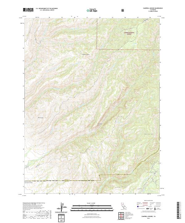
2021 Map of Campbell Mound
USGS Topo · Published 2021About this map
The northern reaches of the Sacramento Valley meet the rising foothills of the Sierra Nevada in this topographic study, where the boundary of Lassen National Forest cuts across a landscape of deep gulches and prominent ridges. The geography is defined by a series of dramatic volcanic and erosion-carved features, most notably the distinct Campbell Mound and the steep elevation of Sugarloaf Mtn. These heights offer a view toward the broad Central Valley to the southwest, while the interior is carved by numerous seasonal drainages such as Rattlesnake Cr and Pine Cr.
Find a feature on this map
42 named features on this map. Tap any name to fly to it.
Don’t see what you’re looking for? This feature index may not catch every label — zoom into the map to look around manually.
Map Details
Editions of this 2021 Campbell Mound Map
This is the sole edition of this map. No revisions or reprints were ever made.
Other maps of this area

1886 · Lassen Peak
USGS Topo · 1:250,000

1891 · Chico
USGS Topo · 1:125,000

1892 · Lassen Peak
USGS Topo · 1:250,000

1893 · Chico
USGS Topo · 1:125,000

1894 · Lassen Peak
USGS Topo · 1:250,000

1895 · Chico
USGS Topo · 1:125,000

1912 · Nord
USGS Topo · 1:31,680

1912 · Keefers
USGS Topo · 1:31,680

1912 · Singer Creek
USGS Topo · 1:31,680

1935 · Paynes Creek
USGS Topo · 1:96,000