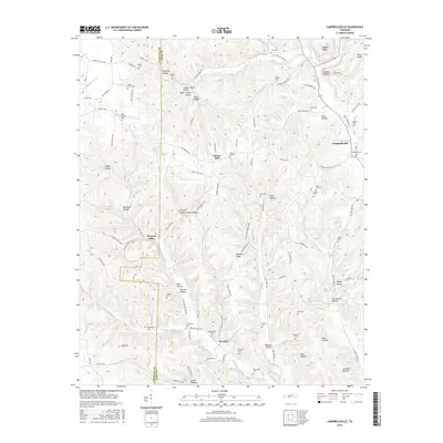
2016 Map of Campbellsville
USGS Topo · Published 2016About this map
The Lawrence and Giles county line bisects this landscape of ridges and creek-fed hollows. The settlement of Campbellsville anchors the eastern edge of the survey, while the small communities of Liberty Hill, Weakley, and Oak Hill are scattered throughout the winding valley networks. This era shows a rural landscape defined by family-named landmarks and numerous small burial grounds, including Rose Hill Cem, Stafford Cem, and Clifton Cem, which suggest long-standing genealogical roots in the area. Drainage is dominated by Factory Creek and several branches of Wet Weakley Creek, with topographic features like Womble Ridge and Nobbin Ridge rising above the bottomlands. The presence of Marcella Falls and Marcella Falls Spring in the northwest indicates a terrain shaped by persistent water sources and natural springs.
Find a feature on this map
121 named features on this map. Tap any name to fly to it.
Don’t see what you’re looking for? This feature index may not catch every label — zoom into the map to look around manually.
Map Details
Editions of this 2016 Campbellsville Map
This is the sole edition of this map. No revisions or reprints were ever made.
Other maps of this area

1936 · Sandy Hook
USGS Topo · 1:24,000

1936 · Milky Way
USGS Topo · 1:24,000

1936 · Campbellsville
USGS Topo · 1:24,000

1936 · Lawrenceburg
USGS Topo · 1:24,000

1936 · Ethridge
USGS Topo · 1:24,000

1936 · Pulaski
USGS Topo · 1:24,000

1936 · Crestview
USGS Topo · 1:24,000

1936 · Bodenham
USGS Topo · 1:24,000

1936 · Lynnville
USGS Topo · 1:24,000

1948 · Bodenham
USGS Topo · 1:24,000