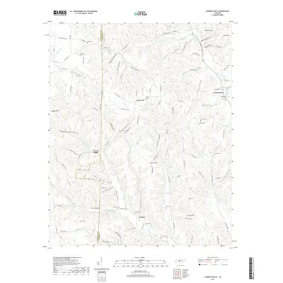
2019 Map of Campbellsville
USGS Topo · Published 2019About this map
The border of Lawrence Co and Giles Co cuts through a landscape defined by deep hollows and narrow ridges in this 2019 survey. The village of Campbellsville anchors the eastern edge of the map, situated near the confluence of Big Cr and Yokley Cr. To the west, the settlements of Pleasant Valley and Weakley occupy the higher ground between the winding paths of Wet Weakley Cr and Dry Weakley Cr.
Find a feature on this map
123 named features on this map. Tap any name to fly to it.
Don’t see what you’re looking for? This feature index may not catch every label — zoom into the map to look around manually.
Map Details
Editions of this 2019 Campbellsville Map
This is the sole edition of this map. No revisions or reprints were ever made.
Other maps of this area

1936 · Sandy Hook
USGS Topo · 1:24,000

1936 · Milky Way
USGS Topo · 1:24,000

1936 · Campbellsville
USGS Topo · 1:24,000

1936 · Lawrenceburg
USGS Topo · 1:24,000

1936 · Ethridge
USGS Topo · 1:24,000

1936 · Pulaski
USGS Topo · 1:24,000

1936 · Crestview
USGS Topo · 1:24,000

1936 · Bodenham
USGS Topo · 1:24,000

1936 · Lynnville
USGS Topo · 1:24,000

1948 · Bodenham
USGS Topo · 1:24,000