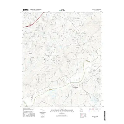
2017 Map of Campbellton
USGS Topo · Published 2017About this map
The Chattahoochee River defines the boundary between Douglas and Fulton counties, carving through a landscape transitioning from the urban footprint of Douglasville to more rural stretches in the south. Aviation history is present through local facilities like Chattahoochee Air Park and the Miller Farm Airport, while the Norfolk Southern rail line supports the regional transportation corridor. Local heritage is anchored by sites such as Central Church, Holly Springs Cem, and McKay Cem, reflecting generations of settlement in communities like Campbellton and Cedar Grove. The terrain is characterized by numerous small water bodies including Sweetwater Lake, Monroe Lake, and Browns Lake, alongside significant elevations like Stembler Ridge and Rocky Face Dr, illustrating the varied geography of the Georgia Piedmont.
Find a feature on this map
280 named features on this map. Tap any name to fly to it.
Don’t see what you’re looking for? This feature index may not catch every label — zoom into the map to look around manually.
Map Details
Editions of this 2017 Campbellton Map
This is the sole edition of this map. No revisions or reprints were ever made.
Other maps of this area

1891 · Marietta
USGS Topo · 1:125,000

1895 · Marietta
USGS Topo · 1:125,000

1897 · Marietta
USGS Topo · 1:125,000

1901 · Marietta
USGS Topo · 1:125,000

1953 · Atlanta
USGS Topo · 1:250,000

1954 · Palmetto
USGS Topo · 1:24,000

1954 · Campbellton
USGS Topo · 1:24,000
1954 · Mableton
USGS Topo · 1:24,000

1954 · Fairburn
USGS Topo · 1:24,000

1954 · Austell
USGS Topo · 1:24,000