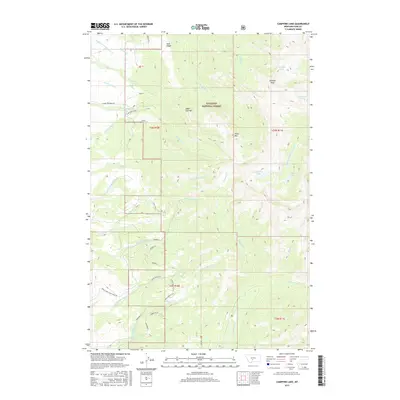
2017 Map of Campfire Lake
USGS Topo · Published 2017About this map
Gallatin National Forest dominates this high-altitude landscape in Park County, where steep drainages and alpine lakes define the wilderness character. The map centers on the headwaters of several major water systems, including the S Fork Shields River and Middle Fork Sweet Grass Cr. High peaks such as Sunlight Peak and Sugar Loaf Mtn rise above the timberline, while Black Mtn stands near the divide between the eastern and western slopes. This region is dotted with high-mountain water bodies, most notably Campfire Lake, Sunlight Lake, and the aptly named Dead Horse Lakes. This 2017 survey details a remote backcountry network of Forest Service infrastructure, including the Lima Corn Connect and Ibex RD, providing precise data for hikers and explorers navigating the drainages of Trespass Cr and Cottonwood Cr.
Find a feature on this map
50 named features on this map. Tap any name to fly to it.
Don’t see what you’re looking for? This feature index may not catch every label — zoom into the map to look around manually.
Map Details
Editions of this 2017 Campfire Lake Map
This is the sole edition of this map. No revisions or reprints were ever made.
Other maps of this area

1886 · Little Belt Mts.
USGS Topo · 1:250,000

1891 · Livingston
USGS Topo · 1:250,000

1893 · Livingston
USGS Topo · 1:250,000

1894 · Little Belt Mts.
USGS Topo · 1:250,000

1897 · Little Belt Mts.
USGS Topo · 1:250,000

1898 · Little Belt Mts.
USGS Topo · 1:250,000

1902 · Little Belt Mts.
USGS Topo · 1:250,000

1947 · Bozeman
USGS Topo · 1:250,000

1948 · Bozeman
USGS Topo · 1:250,000

1948 · White Sulphur Springs
USGS Topo · 1:250,000