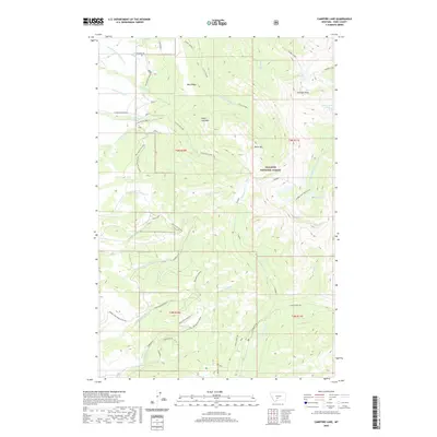
2020 Map of Campfire Lake
USGS Topo · Published 2020About this map
Gallatin National Forest dominates this high-altitude landscape in Park County, where steep drainages and alpine peaks define the geography. The terrain is characterized by a series of prominent summits including Sunlight Peak and Sugar Loaf Mtn, separated by the intricate headwaters of the S Fork Shields River and Middle Fork Sweet Grass Cr. Several small alpine lakes, such as Sunlight Lake, Cottonwood Lake, and Moose Lake, are scattered among the ridges, often serving as the primary landmarks in this roadless area.
Find a feature on this map
51 named features on this map. Tap any name to fly to it.
Don’t see what you’re looking for? This feature index may not catch every label — zoom into the map to look around manually.
Map Details
Editions of this 2020 Campfire Lake Map
This is the sole edition of this map. No revisions or reprints were ever made.
Other maps of this area

1886 · Little Belt Mts.
USGS Topo · 1:250,000

1891 · Livingston
USGS Topo · 1:250,000

1893 · Livingston
USGS Topo · 1:250,000

1894 · Little Belt Mts.
USGS Topo · 1:250,000

1897 · Little Belt Mts.
USGS Topo · 1:250,000

1898 · Little Belt Mts.
USGS Topo · 1:250,000

1902 · Little Belt Mts.
USGS Topo · 1:250,000

1947 · Bozeman
USGS Topo · 1:250,000

1948 · Bozeman
USGS Topo · 1:250,000

1948 · White Sulphur Springs
USGS Topo · 1:250,000