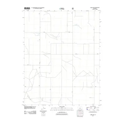
2011 Map of Campo NW
USGS Topo · Published 2011About this map
Sand Arroyo Creek and its seasonal drainage patterns dominate this corner of Baca County, where the high plains landscape is carved by deep arroyos and canyons. The North Fork Cimarron River enters the southeastern section of the quadrangle, mirroring the dramatic geological transition found at North Ute Canyon in the southwest. This area is characterized by a precise rectilinear grid of county roads, including Co Rd T, Co Rd R, and Co Rd M, which reflect the systematic agricultural land division of the region. The map provides a clear view of the rural infrastructure in 2011, highlighting the intersection of human-engineered transport routes like Co Rd 22 5/10 with the natural, winding paths of the local waterways.
Find a feature on this map
13 named features on this map. Tap any name to fly to it.
Don’t see what you’re looking for? This feature index may not catch every label — zoom into the map to look around manually.
Map Details
Editions of this 2011 Campo NW Map
This is the sole edition of this map. No revisions or reprints were ever made.
Other maps of this area

1891 · Springfield
USGS Topo · 1:125,000

1893 · Springfield
USGS Topo · 1:125,000

1955 · La Junta
USGS Topo · 1:250,000

1958 · La Junta
USGS Topo · 1:250,000

1968 · La Junta
USGS Topo · 1:250,000

1978 · Edler
USGS Topo · 1:24,000

1978 · Pritchett
USGS Topo · 1:24,000

1978 · Springfield SW
USGS Topo · 1:24,000
1978 · Campo SW
USGS Topo · 1:24,000

1978 · Campo NE
USGS Topo · 1:24,000