
1978 Map of Springfield SW
USGS Topo · Published 1978About this map
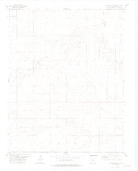
The Colo State Univ Experiment Station occupies the northwest corner of this Colorado landscape, highlighting the intersection of agricultural research and the high plains of Baca County. The settlement of Liberty sits centrally among a network of section lines and unimproved roads that define the rural character of the area in the late 1970s. The terrain is deeply influenced by the seasonal flow of Lone Rock Draw, which snakes across the northern and eastern portions of the sheet. Water management is a primary theme of the landscape, as evidenced by numerous named sources like the Little Bankiter Well and a prominent Pipeline traversing the southern sections. Industrial activity is concentrated at a solitary Gravel Pit near a Radio Tower, while the broader township organization is marked by the crossing of T 31 S T 32 S and R 47 W R 46 W.
Find a feature on this map
11 named features on this map. Tap any name to fly to it.
Don’t see what you’re looking for? This feature index may not catch every label — zoom into the map to look around manually.
Map Details
Editions of this 1978 Springfield SW Map
2 editions found
Other maps of this area

1891 · Springfield
USGS Topo · 1:125,000

1893 · Springfield
USGS Topo · 1:125,000

1955 · La Junta
USGS Topo · 1:250,000

1958 · La Junta
USGS Topo · 1:250,000

1968 · La Junta
USGS Topo · 1:250,000

1978 · Edler
USGS Topo · 1:24,000

1978 · Pritchett
USGS Topo · 1:24,000

1978 · Campo NE
USGS Topo · 1:24,000
1978 · Harbord
USGS Topo · 1:24,000
1978 · Bisonte
USGS Topo · 1:24,000