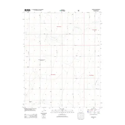
2013 Map of Campo NW
USGS Topo · Published 2013About this map
The Comanche National Grassland dominates this portion of the High Plains in southeastern Colorado, showcasing a landscape defined by its conservation history and drainage patterns. The ephemeral waters of Sand Arroyo Creek meander across the northern sections, while the North Fork Cimarron River cuts through the southern reaches of the quadrangle. This 2013 survey illustrates the sparse, grid-based infrastructure of Baca County, where long stretches of county roads like Co Road T and Co Road 20 connect isolated ranches and agricultural sections. The map reveals the distinct topography of the High Plains, including the cut of North Ute Canyon in the southwest corner, offering a clear view of the area's transition from open prairie to more defined drainage basins.
Find a feature on this map
25 named features on this map. Tap any name to fly to it.
Don’t see what you’re looking for? This feature index may not catch every label — zoom into the map to look around manually.
Map Details
Editions of this 2013 Campo NW Map
This is the sole edition of this map. No revisions or reprints were ever made.
Other maps of this area

1891 · Springfield
USGS Topo · 1:125,000

1893 · Springfield
USGS Topo · 1:125,000

1955 · La Junta
USGS Topo · 1:250,000

1958 · La Junta
USGS Topo · 1:250,000

1968 · La Junta
USGS Topo · 1:250,000

1978 · Edler
USGS Topo · 1:24,000

1978 · Pritchett
USGS Topo · 1:24,000

1978 · Springfield SW
USGS Topo · 1:24,000
1978 · Campo SW
USGS Topo · 1:24,000

1978 · Campo NE
USGS Topo · 1:24,000