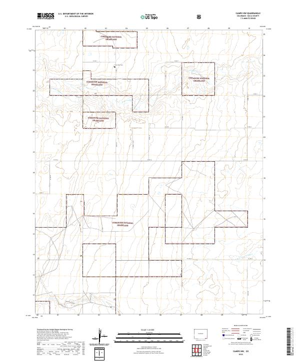
2022 Map of Campo NW
USGS Topo · Published 2022About this map
The Comanche National Grassland dominates this corner of Baca County, where the high plains landscape is defined by its drainage systems and a rigorous grid of section lines. The vast grasslands are incised by the seasonal flows of Sand Arroyo Cr and the N Fork Cimarron River, which carve into the terrain to form landmarks like North Utz Canyon. This map reveals a sparse but deeply intentional human footprint, where long stretches of county roads like Co RD T and Co RD 25 facilitate movement across the remote prairie. A significant point for local history is the Lone Star Cem, located in the northern reaches near the township line of t32s r47w. The absence of dense settlements underscores the area's dedication to conservation and rangeland management in the modern era.
Find a feature on this map
23 named features on this map. Tap any name to fly to it.
Don’t see what you’re looking for? This feature index may not catch every label — zoom into the map to look around manually.
Map Details
Editions of this 2022 Campo NW Map
This is the sole edition of this map. No revisions or reprints were ever made.
Other maps of this area

1891 · Springfield
USGS Topo · 1:125,000

1893 · Springfield
USGS Topo · 1:125,000

1955 · La Junta
USGS Topo · 1:250,000

1958 · La Junta
USGS Topo · 1:250,000

1968 · La Junta
USGS Topo · 1:250,000

1978 · Edler
USGS Topo · 1:24,000

1978 · Pritchett
USGS Topo · 1:24,000

1978 · Springfield SW
USGS Topo · 1:24,000
1978 · Campo SW
USGS Topo · 1:24,000

1978 · Campo NE
USGS Topo · 1:24,000