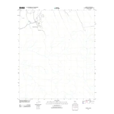
2012 Map of Campo
USGS Topo · Published 2012About this map
Campo and its surrounding ranch lands occupy this high-desert landscape in southern San Diego County, situated just north of the international border. The community is defined by a cluster of residential and administrative roads, including Sheridan Rd and Custer Rd, which connect the settlement to Campo Valley and the waters of Campo Lake. The map reveals a transition between rural ranching operations and the natural drainage patterns of the region, where Campo Cr winds through the valley floor. To the north and east, the terrain becomes more sparse, marked by the long reach of Shockey Truck Trl and Far Valley Rd. Private holdings like Rancho Del Campo, Curro Ranch, and Castle Rock Ranch establish the historical footprint of this borderland area, illustrating how local families and institutions have utilized the valley's geography for decades.
Find a feature on this map
16 named features on this map. Tap any name to fly to it.
Don’t see what you’re looking for? This feature index may not catch every label — zoom into the map to look around manually.
Map Details
Editions of this 2012 Campo Map
This is the sole edition of this map. No revisions or reprints were ever made.
Other maps of this area

1903 · Cuyamaca
USGS Topo · 1:125,000

1904 · Southern California Sheet No. 2
USGS Topo · 1:250,000

1931 · Carrizo
USGS Topo · 1:125,000

1939 · Campo
USGS Topo · 1:62,500

1942 · Potrero
USGS Topo · 1:48,000

1942 · Campo
USGS Topo · 1:62,500

1944 · Potrero
USGS Topo · 1:62,500

1950 · San Diego
USGS Topo · 1:250,000

1954 · San Diego
USGS Topo · 1:250,000

1955 · San Diego
USGS Topo · 1:250,000