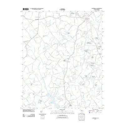
2011 Map of Campobello
USGS Topo · Published 2011About this map
Campobello and the surrounding Spartanburg County orchard and farm country are defined by a network of rivers and man-made impoundments. The South Pacolet River cuts through the northern landscape, while the Middle Tyger River and North Tyger River drain the southern reaches towards Lyman Lake. This 2011 survey reveals an area where water management is central to the land, evidenced by numerous named dams and ponds such as Gramling Brothers Lake Dam Five and Vaughn Pond.
Find a feature on this map
200 named features on this map. Tap any name to fly to it.
Don’t see what you’re looking for? This feature index may not catch every label — zoom into the map to look around manually.
Map Details
Editions of this 2011 Campobello Map
This is the sole edition of this map. No revisions or reprints were ever made.
Other maps of this area

1907 · Saluda
USGS Topo · 1:125,000

1935 · Greer
USGS Topo · 1:48,000

1935 · Greenville
USGS Topo · 1:48,000

1938 · Greenville
USGS Topo · 1:62,500

1938 · Greer
USGS Topo · 1:62,500

1954 · Greenville
USGS Topo · 1:250,000

1955 · Knoxville
USGS Topo · 1:250,000

1957 · Greer
USGS Topo · 1:62,500

1957 · Greenville
USGS Topo · 1:62,500

1957 · Knoxville
USGS Topo · 1:250,000