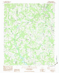
1983 Map of Campobello
USGS Topo · Published 1983About this map
The Middle Tyger River and its numerous tributaries, including Motlow Creek and Beaverdam Creek, carve through this landscape along the Greenville-Spartanburg county line. The area centers on the town of Campobello, where the Southern Railroad passes near industrial ponds and the Pacolet River. This 1980s-era documentation shows a community defined by its rural institutions, with small crossroads such as Little Chicago and Gowensville serving as local hubs. Educational and religious life is well-marked through features like the Campobello-Gramling School and Holly Springs-Motlow School, alongside numerous country churches like Bethel Church and Macedonia Church. Aviation history is noted by the presence of Campobello Airport and Sloan Airport. To the south, the waters of Lyman Lake create a distinct geographic boundary near the settlement of Holly Springs.
Find a feature on this map
37 named features on this map. Tap any name to fly to it.
Don’t see what you’re looking for? This feature index may not catch every label — zoom into the map to look around manually.
Map Details
Editions of this 1983 Campobello Map
This is the sole edition of this map. No revisions or reprints were ever made.
Other maps of this area

1907 · Saluda
USGS Topo · 1:125,000

1935 · Greer
USGS Topo · 1:48,000

1935 · Greenville
USGS Topo · 1:48,000

1938 · Greenville
USGS Topo · 1:62,500

1938 · Greer
USGS Topo · 1:62,500

1954 · Greenville
USGS Topo · 1:250,000

1955 · Knoxville
USGS Topo · 1:250,000

1957 · Greer
USGS Topo · 1:62,500

1957 · Greenville
USGS Topo · 1:62,500

1957 · Knoxville
USGS Topo · 1:250,000