
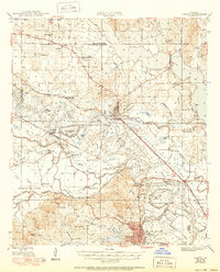
1948 Map of Campti
USGS Topo · Published 1948About this map
The Red River twists through a complex landscape of alluvial lowlands and oxbow lakes in this late 1940s survey of Natchitoches Parish. The settlement of Campti sits at a critical bend in the river, serving as a focal point where the Louisiana and Arkansas railroad meets the water. To the west, the Old Spanish Lake Lowlands and Bayou Pierre reveal the intricate drainage patterns of the Red River Valley before modern channelization.
Find a feature on this map
95 named features on this map. Tap any name to fly to it.
Don’t see what you’re looking for? This feature index may not catch every label — zoom into the map to look around manually.
Map Details
Editions of this 1948 Campti Map
2 editions found
Other maps of this area

1935 · Hagewood
USGS Topo · 1:31,680

1937 · Campti NE
USGS Topo · 1:31,680

1937 · Bermuda
USGS Topo · 1:31,680

1937 · Campti SE
USGS Topo · 1:31,680

1937 · Campti NW
USGS Topo · 1:31,680

1937 · Montgomery
USGS Topo · 1:62,500

1937 · Campti SW
USGS Topo · 1:31,680

1938 · Allen
USGS Topo · 1:31,680

1938 · Lake End
USGS Topo · 1:31,680

1942 · Many
USGS Topo · 1:62,500