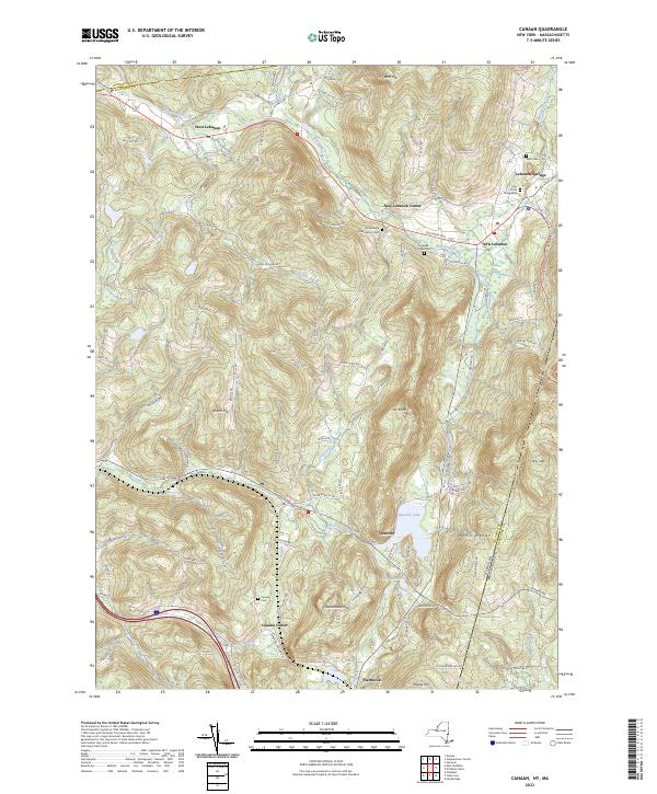
2023 Map of Canaan
USGS Topo · Published 2023About this map
Lebanon Springs and New Lebanon anchor this landscape along the border of New York and Massachusetts, where the western slopes of the Taconic Range meet the valleys of Wyomanock Creek. The terrain is defined by a series of prominent peaks and hollows, including Perry Peak and the distinctive Rattlesnake Den. Settlement patterns follow the winding paths of Kinderhook Creek and the South Branch Wyomanock Creek, connecting a string of small communities from West Lebanon to the southern hamlet of Flatbrook.
Find a feature on this map
111 named features on this map. Tap any name to fly to it.
Don’t see what you’re looking for? This feature index may not catch every label — zoom into the map to look around manually.
Map Details
Editions of this 2023 Canaan Map
This is the sole edition of this map. No revisions or reprints were ever made.
Other maps of this area

1888 · Berlin
USGS Topo · 1:62,500

1888 · Pittsfield
USGS Topo · 1:62,500

1890 · Pittsfield
USGS Topo · 1:62,500

1890 · Berlin
USGS Topo · 1:62,500

1893 · Troy
USGS Topo · 1:62,500

1893 · Pittsfield
USGS Topo · 1:62,500

1894 · Berlin
USGS Topo · 1:62,500

1894 · Pittsfield
USGS Topo · 1:62,500

1895 · Troy
USGS Topo · 1:62,500

1897 · Pittsfield
USGS Topo · 1:62,500