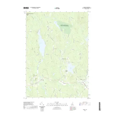
2021 Map of Canaan
USGS Topo · Published 2021About this map
The Mascoma River and Indian River valley define this portion of Grafton County, anchoring a series of distinct villages that reflect centuries of inland New Hampshire settlement. Canaan serves as the primary hub, situated near the western edge of Canaan Street Lake, while the older historical core at Canaan Street and the northern Canaan Center sit on higher ground to the north. This upland character is most prominent in the northwestern corner, where the Appalachian National Scenic Trail traverses the heights above Goose Pond.
Find a feature on this map
98 named features on this map. Tap any name to fly to it.
Don’t see what you’re looking for? This feature index may not catch every label — zoom into the map to look around manually.
Map Details
Editions of this 2021 Canaan Map
This is the sole edition of this map. No revisions or reprints were ever made.
Other maps of this area

1927 · Cardigan
USGS Topo · 1:62,500

1927 · Mascoma
USGS Topo · 1:62,500

1928 · Rumney
USGS Topo · 1:62,500

1930 · Cardigan
USGS Topo · 1:62,500

1931 · Mt. Cube
USGS Topo · 1:62,500

1932 · Mascoma
USGS Topo · 1:62,500

1932 · Rumney
USGS Topo · 1:62,500

1933 · Mt. Cube
USGS Topo · 1:62,500

1949 · Portland
USGS Topo · 1:250,000

1950 · Glens Falls
USGS Topo · 1:250,000