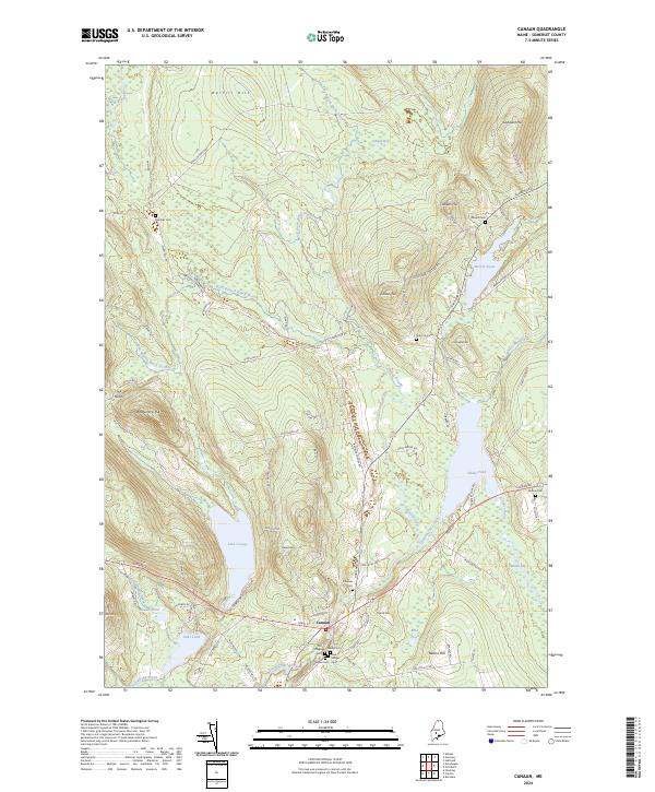
2024 Map of Canaan
USGS Topo · Published 2024About this map
Canaan serves as the central hub of this Somerset County landscape, situated at the confluence of several vital watercourses including Carrabassett Stream and Stafford Brook. The village layout is deeply connected to its historical burial grounds, with a high concentration of sites such as the Old Village Cem, New Village Cem, and Walker Cem clustered south of the main settlement. The surrounding terrain is defined by a series of prominent rises like Chase Hill and Nelson Hill, which overlook a complex network of wetlands and ponds. Large water bodies such as Lake George and Sibley Pond dominate the southern half of the quadrangle, while the northern reaches are characterized by the winding paths of the West Branch Black Stream and East Branch Black Stream. This geography suggests a long history of water-dependent industry and transit, with roads like Browns Corner Rd and Hartland Rd linking the town to the surrounding rural ridges.
Find a feature on this map
90 named features on this map. Tap any name to fly to it.
Don’t see what you’re looking for? This feature index may not catch every label — zoom into the map to look around manually.
Map Details
Editions of this 2024 Canaan Map
This is the sole edition of this map. No revisions or reprints were ever made.
Other maps of this area

1892 · Waterville
USGS Topo · 1:62,500

1913 · Skowhegan
USGS Topo · 1:62,500

1926 · Burnham
USGS Topo · 1:62,500

1930 · Pittsfield
USGS Topo · 1:48,000

1932 · Pittsfield
USGS Topo · 1:62,500

1933 · Pittsfield
USGS Topo · 1:62,500

1943 · Waterville
USGS Topo · 1:62,500

1948 · Bangor
USGS Topo · 1:250,000

1955 · Pittsfield
USGS Topo · 1:62,500

1955 · Skowhegan
USGS Topo · 1:62,500