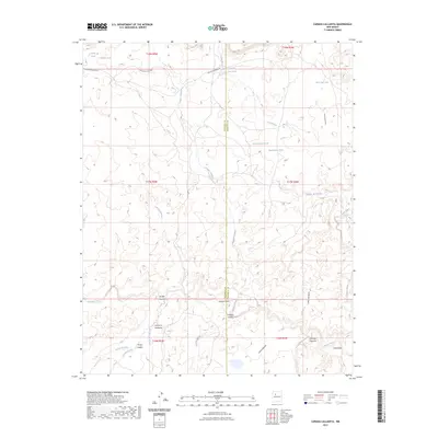
2023 Map of Canada Calladita
USGS Topo · Published 2023About this map
Arroyo Chico and Cañada Calladita carve through this high-desert landscape on the border of McKinley and Sandoval Counties. This modern survey illustrates the critical role of water management in a dry environment, documented through a dense network of specialized catchment points such as Cholla Tank, Sand Column Tank, and Rattlesnake Tank. These features represent the essential infrastructure for ranching and land use in the region. Transportation is defined by the Rincon Marquez Rd and Navajo Svc Rte 7004, providing access to the various canyons like Cañon Ignacio Rico and the drainage systems of Torreon Wash. The geography is further detailed by the convergence of several arroyos, including Arroyo Gallina and Arroyo Seccion, which shape the local drainage patterns near Cañoncito.
Find a feature on this map
25 named features on this map. Tap any name to fly to it.
Don’t see what you’re looking for? This feature index may not catch every label — zoom into the map to look around manually.
Map Details
Editions of this 2023 Canada Calladita Map
This is the sole edition of this map. No revisions or reprints were ever made.
Other maps of this area

1883 · Mt. Taylor
USGS Topo · 1:250,000

1886 · Mt. Taylor
USGS Topo · 1:250,000

1892 · Mt. Taylor
USGS Topo · 1:250,000

1899 · Mt. Taylor
USGS Topo · 1:250,000

1958 · Albuquerque
USGS Topo · 1:250,000

1961 · Cerro Parido
USGS Topo · 1:24,000

1961 · Mesita Del Gavilan
USGS Topo · 1:24,000

1961 · Arroyo Empedrado
USGS Topo · 1:24,000
1961 · Canada Calladita
USGS Topo · 1:24,000
1961 · Tinian
USGS Topo · 1:24,000