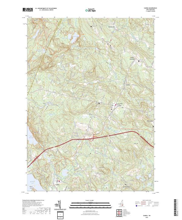
2024 Map of Candia
USGS Topo · Published 2024About this map
Candia Four Corners and the surrounding hamlets of East Candia and South Deerfield anchor this portion of Rockingham County, characterized by a complex network of brooks and wetlands. The landscape is defined by the headwaters of the North Branch River and numerous ponds, including Kinnicum Pond and Tower Hill Pond. The southern reaches transition toward the larger waters of Massabesic Lake and Little Massabesic Brook, where the settlement of Auburn is situated.
Find a feature on this map
122 named features on this map. Tap any name to fly to it.
Don’t see what you’re looking for? This feature index may not catch every label — zoom into the map to look around manually.
Map Details
Editions of this 2024 Candia Map
This is the sole edition of this map. No revisions or reprints were ever made.
Other maps of this area

1888 · Haverhill
USGS Topo · 1:62,500

1890 · Haverhill
USGS Topo · 1:62,500

1893 · Haverhill
USGS Topo · 1:62,500

1905 · Manchester
USGS Topo · 1:62,500

1917 · Mt. Pawtuckaway
USGS Topo · 1:62,500

1919 · Mt. Pawtuckaway
USGS Topo · 1:62,500

1921 · Suncook
USGS Topo · 1:62,500

1935 · Haverhill
USGS Topo · 1:62,500

1939 · Mt. Pawtuckaway
USGS Topo · 1:62,500

1941 · Manchester
USGS Topo · 1:62,500