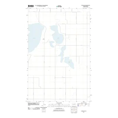
2011 Map of Cando SE
USGS Topo · Published 2011About this map
Almlie Cemetery sits centrally in this Towner County landscape, serving as a primary point of interest for genealogists and local historians. The geography is dominated by a chain of water bodies, including the expansive Lake Alice, the central Chain Lake, and Mikes Lake to the southeast. These lakes are connected by a rigid, mile-by-mile grid of section roads typical of the North Dakota prairie, with 71st Ave Ne and 74th Ave Ne providing north-south transit. Along the northern edge, County Hwy-10 serves as the main east-west artery. The spatial arrangement of these features suggests a region primarily dedicated to agriculture, where the natural hydrology of the lakes dictates the placement of rural infrastructure and family landmarks.
Find a feature on this map
19 named features on this map. Tap any name to fly to it.
Don’t see what you’re looking for? This feature index may not catch every label — zoom into the map to look around manually.
Map Details
Editions of this 2011 Cando SE Map
This is the sole edition of this map. No revisions or reprints were ever made.
Other maps of this area

1931 · Devils Lake
USGS Topo · 1:62,500

1932 · Grahams Island
USGS Topo · 1:62,500

1950 · Grahams Island
USGS Topo · 1:62,500

1950 · Devils Lake
USGS Topo · 1:62,500

1951 · Tilden
USGS Topo · 1:24,000

1951 · Grand Harbor
USGS Topo · 1:24,000

1951 · Penn
USGS Topo · 1:24,000

1953 · Devils Lake
USGS Topo · 1:250,000

1956 · Devils Lake
USGS Topo · 1:250,000

1957 · Cando SE
USGS Topo · 1:24,000