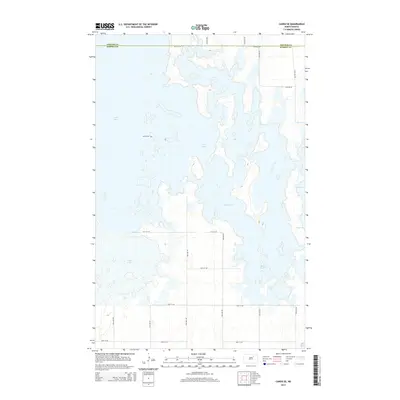
2014 Map of Cando SE
USGS Topo · Published 2014About this map
The boundary between Towner Co and Ramsey Co bisects a landscape dominated by a complex, interconnected system of wetlands and prairie potholes. This 2014 survey illustrates the hydrologic relationship between Lake Alice, Chain Lake, and Lake Irvine, which form a vital corridor for migratory birds in the Devils Lake Basin. A grid of section roads, such as 66th St NE and 74th Ave NE, provides access to the surrounding agricultural tracts. Near the western edge of Chain Lake, the Almlie Cem stands as a local genealogical landmark, marking the presence of early settlers who established roots in this water-rich region. The map also captures the seasonal character of the basin, identifying several basins as Dry Lake and documenting smaller features like Mikes Lake.
Find a feature on this map
19 named features on this map. Tap any name to fly to it.
Don’t see what you’re looking for? This feature index may not catch every label — zoom into the map to look around manually.
Map Details
Editions of this 2014 Cando SE Map
This is the sole edition of this map. No revisions or reprints were ever made.
Other maps of this area

1931 · Devils Lake
USGS Topo · 1:62,500

1932 · Grahams Island
USGS Topo · 1:62,500

1950 · Grahams Island
USGS Topo · 1:62,500

1950 · Devils Lake
USGS Topo · 1:62,500

1951 · Tilden
USGS Topo · 1:24,000

1951 · Grand Harbor
USGS Topo · 1:24,000

1951 · Penn
USGS Topo · 1:24,000

1953 · Devils Lake
USGS Topo · 1:250,000

1956 · Devils Lake
USGS Topo · 1:250,000

1957 · Cando SE
USGS Topo · 1:24,000