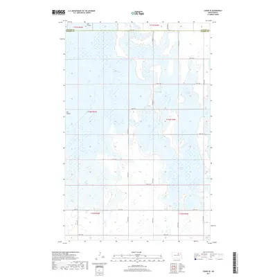
2017 Map of Cando SE
USGS Topo · Published 2017About this map
The low-lying wetlands of the Devils Lake Basin dominate this 2017 landscape, where the northern border of Ramsey County meets southern Towner County. A vast network of interconnected water bodies, including Chain Lake and Lake Alice, characterizes the region's hydrography. These basins are critical components of the local drainage system, which features the prominent Big Coulee cutting through the western sections. The geography here is a shifting mosaic of seasonal water and prairie, with Lake Irvine and Mikes Lake illustrating the erratic nature of North Dakota's glacial lake plains.
Find a feature on this map
29 named features on this map. Tap any name to fly to it.
Don’t see what you’re looking for? This feature index may not catch every label — zoom into the map to look around manually.
Map Details
Editions of this 2017 Cando SE Map
This is the sole edition of this map. No revisions or reprints were ever made.
Other maps of this area

1931 · Devils Lake
USGS Topo · 1:62,500

1932 · Grahams Island
USGS Topo · 1:62,500

1950 · Grahams Island
USGS Topo · 1:62,500

1950 · Devils Lake
USGS Topo · 1:62,500

1951 · Tilden
USGS Topo · 1:24,000

1951 · Grand Harbor
USGS Topo · 1:24,000

1951 · Penn
USGS Topo · 1:24,000

1953 · Devils Lake
USGS Topo · 1:250,000

1956 · Devils Lake
USGS Topo · 1:250,000

1957 · Cando SE
USGS Topo · 1:24,000