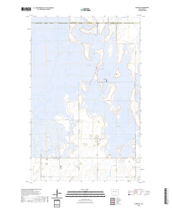
2024 Map of Cando SE
USGS Topo · Published 2024About this map
Lake Alice National Wildlife Refuge and the surrounding prairie pothole wetlands dominate this portion of Ramsey Co and Towner Co. The landscape is a network of sprawling water bodies, including Lake Alice, Chain Lake, and Lake Irvine, connected by low-lying basins that serve as critical habitats. This contemporary survey shows how the land is primarily managed for conservation and wildlife, with several sections dedicated as Ramsey County Waterfowl Production Area. Human settlement is sparse, marked primarily by a grid of rural section roads like 66th St NE and 59th St NE. A significant cultural landmark is the Chain Lake Lutheran Cem, situated on a peninsula between Chain Lake and Dry Lake, providing a specific point of interest for genealogists researching the early families who settled this marshy terrain.
Find a feature on this map
26 named features on this map. Tap any name to fly to it.
Don’t see what you’re looking for? This feature index may not catch every label — zoom into the map to look around manually.
Map Details
Editions of this 2024 Cando SE Map
This is the sole edition of this map. No revisions or reprints were ever made.
Other maps of this area

1931 · Devils Lake
USGS Topo · 1:62,500

1932 · Grahams Island
USGS Topo · 1:62,500

1950 · Grahams Island
USGS Topo · 1:62,500

1950 · Devils Lake
USGS Topo · 1:62,500

1951 · Tilden
USGS Topo · 1:24,000

1951 · Grand Harbor
USGS Topo · 1:24,000

1951 · Penn
USGS Topo · 1:24,000

1953 · Devils Lake
USGS Topo · 1:250,000

1956 · Devils Lake
USGS Topo · 1:250,000

1957 · Cando SE
USGS Topo · 1:24,000