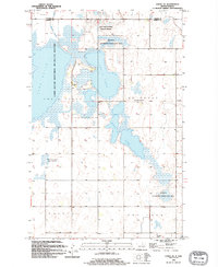
1994 Map of Cando SE
USGS Topo · Published 1994About this map
The low-lying wetlands of the Devils Lake Basin define this landscape along the border of Towner and Ramsey Counties. Dominated by the expansive Lake Alice and the interconnected Chain Lakes, the area is heavily managed for conservation through the Lake Alice National Wildlife Refuge and several large tracts of National Waterfowl Production Area. This environment, characterized by glacial depressions and intermittent watercourses like Mauvais Coulee, reflects the hydraulic complexity of the North Dakota prairie pothole region.
Find a feature on this map
15 named features on this map. Tap any name to fly to it.
Don’t see what you’re looking for? This feature index may not catch every label — zoom into the map to look around manually.
Map Details
Editions of this 1994 Cando SE Map
This is the sole edition of this map. No revisions or reprints were ever made.
Other maps of this area

1931 · Devils Lake
USGS Topo · 1:62,500

1932 · Grahams Island
USGS Topo · 1:62,500

1950 · Grahams Island
USGS Topo · 1:62,500

1950 · Devils Lake
USGS Topo · 1:62,500

1951 · Tilden
USGS Topo · 1:24,000

1951 · Grand Harbor
USGS Topo · 1:24,000

1951 · Penn
USGS Topo · 1:24,000

1953 · Devils Lake
USGS Topo · 1:250,000

1956 · Devils Lake
USGS Topo · 1:250,000

1957 · Cando SE
USGS Topo · 1:24,000