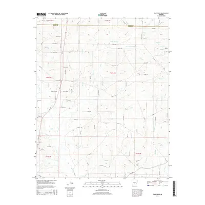
2014 Map of Cane Creek
USGS Topo · Published 2014About this map
Orion and the surrounding drainage basins of Grant County define this rural landscape as it appeared in the early 21st century. The map detail highlights a dense network of local roads such as Stagecoach Rd and Prices Rd that connect scattered family cemeteries, including Gum Springs Cem and Jackson Cem. The terrain is characterized by a complex hydraulic system where the Hurricane Creek and its many tributaries, such as Railroad Br and Price Br, meander through the timbered lowlands. These water features, including Campbell Bayou near the northern boundary, have historically shaped the settlement patterns and road placements in this portion of Arkansas. Genealogists will find the exact placement of local landmarks like Orion Cem and the S Marlow Cem invaluable for locating family burial sites in relation to the evolving road network.
Find a feature on this map
89 named features on this map. Tap any name to fly to it.
Don’t see what you’re looking for? This feature index may not catch every label — zoom into the map to look around manually.
Map Details
Editions of this 2014 Cane Creek Map
This is the sole edition of this map. No revisions or reprints were ever made.
Other maps of this area

1891 · Little Rock
USGS Topo · 1:125,000

1893 · Little Rock
USGS Topo · 1:125,000

1932 · Pastoria
USGS Topo · 1:62,500

1935 · Alexander
USGS Topo · 1:48,000

1935 · Pastoria
USGS Topo · 1:62,500

1940 · Woodson
USGS Topo · 1:31,680

1941 · Alexander
USGS Topo · 1:62,500

1944 · Spring Lake
USGS Topo · 1:31,680

1944 · Bryant
USGS Topo · 1:31,680
1954 · Woodson
USGS Topo · 1:24,000