
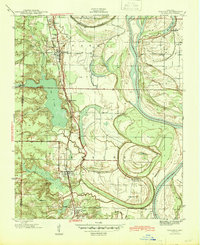
1940 Map of Woodson
USGS Topo · Published 1945About this map
The Arkansas River meanders through this portion of Pulaski County during the late 1930s, shaping a landscape defined by complex bayous and oxbow lakes. The Missouri Pacific railroad serves as the primary inland corridor, connecting the settlements of Wrightsville, Woodson, and Hensley. This survey, conducted as part of a Works Projects Administration effort, reveals a community structured around rural institutions, featuring numerous congregations such as Virginia Ch, Do Right Ch, and Cephas Ch. The presence of the State Industrial School near Fourche Bayou and the Nelson Sch further east highlights the era’s educational and social infrastructure. Water dominates the eastern half of the map, where the Old River Lake and Pennington Bayou frame the low-lying bottomlands, while the western side is marked by the expansive Big Lake and the winding Lorance Cr.
Find a feature on this map
29 named features on this map. Tap any name to fly to it.
Don’t see what you’re looking for? This feature index may not catch every label — zoom into the map to look around manually.
Map Details
Editions of this 1940 Woodson Map
2 editions found
Other maps of this area

1891 · Little Rock
USGS Topo · 1:125,000

1893 · Little Rock
USGS Topo · 1:125,000

1932 · Pastoria
USGS Topo · 1:62,500

1935 · Little Rock
USGS Topo · 1:24,000

1935 · Sweet Home
USGS Topo · 1:24,000

1935 · Alexander
USGS Topo · 1:48,000

1935 · Pastoria
USGS Topo · 1:62,500

1939 · Keo
USGS Topo · 1:31,680

1941 · Alexander
USGS Topo · 1:62,500

1941 · Keo
USGS Topo · 1:31,680