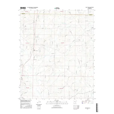
2017 Map of Cane Creek
USGS Topo · Published 2017About this map
Cane Creek and the surrounding timberlands of the Saline and Grant County border define this landscape in the mid-2010s. The settlement of Orion sits in the northeastern corner, characterized by a network of forest roads and small creek drainages like Jerning Br and Wildcat Cr. This area is notable for its numerous burial grounds, including the Gum Springs Cem and Jackson Cem, which serve as vital markers for genealogical research in this part of Arkansas.
Find a feature on this map
114 named features on this map. Tap any name to fly to it.
Don’t see what you’re looking for? This feature index may not catch every label — zoom into the map to look around manually.
Map Details
Editions of this 2017 Cane Creek Map
This is the sole edition of this map. No revisions or reprints were ever made.
Other maps of this area

1891 · Little Rock
USGS Topo · 1:125,000

1893 · Little Rock
USGS Topo · 1:125,000

1932 · Pastoria
USGS Topo · 1:62,500

1935 · Alexander
USGS Topo · 1:48,000

1935 · Pastoria
USGS Topo · 1:62,500

1940 · Woodson
USGS Topo · 1:31,680

1941 · Alexander
USGS Topo · 1:62,500

1944 · Spring Lake
USGS Topo · 1:31,680

1944 · Bryant
USGS Topo · 1:31,680
1954 · Woodson
USGS Topo · 1:24,000