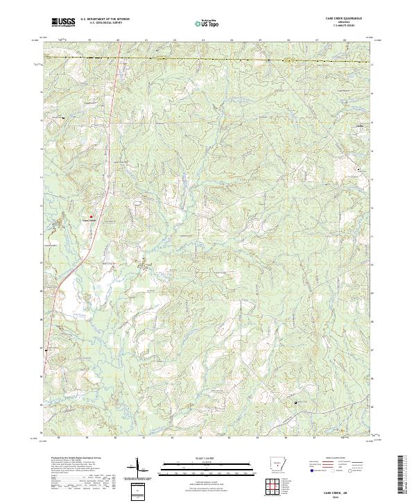
2024 Map of Cane Creek
USGS Topo · Published 2024About this map
Hurricane Creek and its many tributaries, such as Railroad Branch and Poly Branch, define the rolling woodland terrain of this part of Grant County. The landscape is dotted with small, established settlements like Cane Creek and Orion, which serve as anchors for the surrounding rural community. The area is characterized by a dense network of forest roads, including Forest Rd 9967 and Forest Rd 9940, suggesting a landscape deeply involved in timber management or conservation. Genealogy researchers will find several well-preserved burial sites, such as Gum Springs Cem and Jackson Cem, which are tucked away near the headwaters of local streams like Spring Rd and Mud Creek. The transition from Saline County to Grant County is marked by the meandering paths of Miller Creek and Campbell Bayou in the north.
Find a feature on this map
116 named features on this map. Tap any name to fly to it.
Don’t see what you’re looking for? This feature index may not catch every label — zoom into the map to look around manually.
Map Details
Editions of this 2024 Cane Creek Map
This is the sole edition of this map. No revisions or reprints were ever made.
Other maps of this area

1891 · Little Rock
USGS Topo · 1:125,000

1893 · Little Rock
USGS Topo · 1:125,000

1932 · Pastoria
USGS Topo · 1:62,500

1935 · Alexander
USGS Topo · 1:48,000

1935 · Pastoria
USGS Topo · 1:62,500

1940 · Woodson
USGS Topo · 1:31,680

1941 · Alexander
USGS Topo · 1:62,500

1944 · Spring Lake
USGS Topo · 1:31,680

1944 · Bryant
USGS Topo · 1:31,680
1954 · Woodson
USGS Topo · 1:24,000