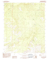
1985 Map of Cane Springs Mountain
USGS Topo · Published 1985About this map
Cane Springs Mountain and the neighboring Black Rock Mountain dominate this corner of Mohave County as it appeared in the mid-1980s. The landscape is defined by the drainage patterns of several significant washes, including Tom and Cull Wash, Cottonwood Wash, and Pocum Wash, which cut through the high desert terrain. This provisional U.S. Geological Survey study captures a moment in the region's ranching and natural history, marking localized water sources like Sand Spring, Mud Springs, and Cane Springs that were vital for livestock and survival in this arid environment. Wide basins such as Sand Cove and Pocum Cove provide geographical context to the drainage network, while a single Corral and the winding Corral Canyon suggest the enduring presence of cattle work in the rugged Arizona interior.
Find a feature on this map
14 named features on this map. Tap any name to fly to it.
Don’t see what you’re looking for? This feature index may not catch every label — zoom into the map to look around manually.
Map Details
Editions of this 1985 Cane Springs Mountain Map
This is the sole edition of this map. No revisions or reprints were ever made.
Other maps of this area

1887 · Verde
USGS Topo · 1:250,000

1892 · Verde
USGS Topo · 1:250,000

1929 · Turret Peak
USGS Topo · 1:125,000

1933 · Turret Peak
USGS Topo · 1:125,000

1934 · Pine
USGS Topo · 1:62,500

1936 · Payson
USGS Topo · 1:48,000

1940 · Pine
USGS Topo · 1:62,500

1942 · Payson
USGS Topo · 1:62,500

1952 · Pine
USGS Topo · 1:62,500

1954 · Holbrook
USGS Topo · 1:250,000