Loading...
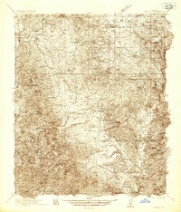
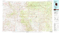
Loading map...1936 Map of Payson
USGS Topo · Published 1936About this map
Mining operations and cattle ranches define the high-country landscape of the Tonto National Forest in the mid-1930s. This survey records a transition from the ancient past to modern utility, documenting numerous Indian Ruins and The Box (Indian Ruins) alongside active industrial sites like the Pittsburg Tonto Mine and Silver Pine Mine. Settlers and ranchers established themselves along the drainage of Tonto Creek, with family-named holdings such as the Seventy-Six Ranch, Bar T-Bar Ranch, and Taylor Ranch scattered throughout the territory.
Find a feature on this map
62 named features on this map. Tap any name to fly to it.
Don’t see what you’re looking for? This feature index may not catch every label — zoom into the map to look around manually.
Map Details
Date Portrayed1936
Date Published1936
PublisherU.S. Geological Survey
Map TypeTopographic
Scale1:48,000
Physical Dimensions22.9 x 26.8 inches
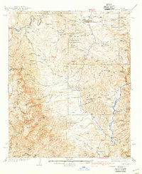
Editions of this 1936 Payson Map
3 editions found
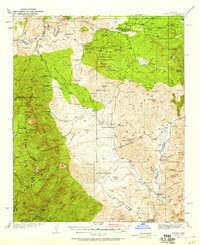
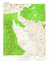
Historical Maps of Payson Through Time
Featured Locations
Source Details
SourceU.S. Geological Survey
CopyrightPublic Domain