
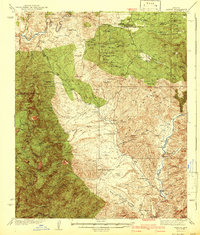
1942 Map of Payson
USGS Topo · Published 1942About this map
Payson serves as the central hub of this Arizona survey, surrounded by a landscape dominated by the Mazatzal Mountains and the winding courses of the Verde River and Tonto Creek. The map reveals a robust mining economy during the mid-1930s, with a dense concentration of claims such as the Silver King Mine, Pay Rock Mine, and Wonder Mine clustered near American Gulch.
Find a feature on this map
115 named features on this map. Tap any name to fly to it.
Don’t see what you’re looking for? This feature index may not catch every label — zoom into the map to look around manually.
Map Details
Editions of this 1942 Payson Map
2 editions found
Other maps of this area

1887 · Verde
USGS Topo · 1:250,000

1892 · Verde
USGS Topo · 1:250,000

1907 · Roosevelt
USGS Topo · 1:125,000

1909 · Four Peaks
USGS Topo · 1:125,000

1912 · Roosevelt
USGS Topo · 1:125,000

1929 · Turret Peak
USGS Topo · 1:125,000

1930 · Cave Creek
USGS Topo · 1:125,000

1933 · Turret Peak
USGS Topo · 1:125,000

1934 · Pine
USGS Topo · 1:62,500

1934 · Promontory Butte
USGS Topo · 1:62,500