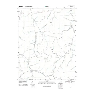
2010 Map of Cannel City
USGS Topo · Published 2010About this map
Caney Creek and its complex network of tributaries, including Poorhouse Fork and Payton Fork, define the settlement patterns of this portion of Wolfe and Morgan counties. The landscape is characterized by narrow hollows and high ridges such as Testerman Knob and Bob Bolin Ridge, with small communities clustered at stream confluences. Several defunct or rural postal centers are recorded here, including the Malone Post Office, Buskirk Post Office, and Insko Post Office, highlighting the area's history of decentralized communication and local commerce.
Find a feature on this map
103 named features on this map. Tap any name to fly to it.
Don’t see what you’re looking for? This feature index may not catch every label — zoom into the map to look around manually.
Map Details
Editions of this 2010 Cannel City Map
This is the sole edition of this map. No revisions or reprints were ever made.
Other maps of this area

1889 · Salyersville
USGS Topo · 1:125,000

1891 · Salyersville
USGS Topo · 1:125,000

1899 · Salyersville
USGS Topo · 1:125,000

1950 · Lenox
USGS Topo · 1:24,000

1951 · Cannel City
USGS Topo · 1:24,000

1951 · Landsaw
USGS Topo · 1:24,000

1951 · White Oak
USGS Topo · 1:24,000

1951 · Ezel
USGS Topo · 1:24,000

1951 · Hazel Green
USGS Topo · 1:24,000
1951 · Lenox
USGS Topo · 1:24,000