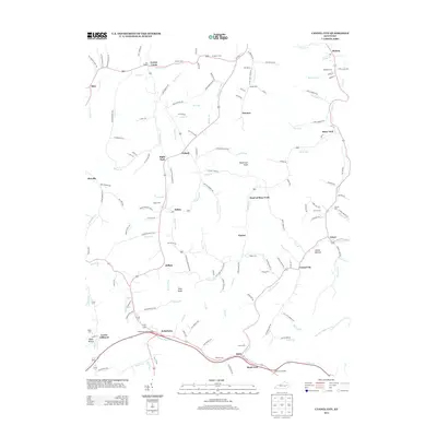
2013 Map of Cannel City
USGS Topo · Published 2013About this map
Cannel City and the surrounding rural communities of Wolfe County are defined by a complex network of narrow hollows and creekside settlements in the early 21st century. The landscape is dotted with numerous family-named burial grounds, including Ferguson Cem, Greear Cem, and Morris Cem, which provide a detailed record of the area's genealogical history. Higher elevations are marked by landmarks like Testerman Knob and Pilot Knob, while the lower valleys support communities such as Salem, Helechawa, and Saints Bottom. The road network often follows the contours of the water, with routes like Sellars Fork-Buskirk Rd and Daysboro-Grassy Rd connecting isolated homesteads. This modern survey captures the enduring settlement patterns where the Red River and Stacy Fork have shaped local development, preserving the locations of country churches like The Chapel and numerous rural post offices.
Find a feature on this map
163 named features on this map. Tap any name to fly to it.
Don’t see what you’re looking for? This feature index may not catch every label — zoom into the map to look around manually.
Map Details
Editions of this 2013 Cannel City Map
This is the sole edition of this map. No revisions or reprints were ever made.
Other maps of this area

1889 · Salyersville
USGS Topo · 1:125,000

1891 · Salyersville
USGS Topo · 1:125,000

1899 · Salyersville
USGS Topo · 1:125,000

1950 · Lenox
USGS Topo · 1:24,000

1951 · Cannel City
USGS Topo · 1:24,000

1951 · Landsaw
USGS Topo · 1:24,000

1951 · White Oak
USGS Topo · 1:24,000

1951 · Ezel
USGS Topo · 1:24,000

1951 · Hazel Green
USGS Topo · 1:24,000
1951 · Lenox
USGS Topo · 1:24,000