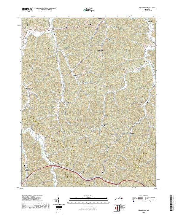
2022 Map of Cannel City
USGS Topo · Published 2022About this map
Cannel City and Helechawa anchor the southern portion of this landscape, where the Morgan Co and Wolfe Co boundary line follows the winding path of the Red River. The terrain is defined by a dense network of narrow hollows and creeks, including Grassy Cr and Lacy Creek, which have dictated the placement of small settlements and family cemeteries for generations. The interior is marked by prominent elevations like Testerman Knob and Pilot Knob, while rural life is documented through numerous named burial grounds such as Greear Cem and Ferguson Cem. Transport patterns across these hills rely on routes like Parkway Rd and State Hwy 705, which connect isolated communities such as Nickell, Panama, and Payton. The prevalence of small, family-named water bodies like Testerman Br and Stacy Fork illustrates a deeply localized sense of place in this part of Eastern Kentucky.
Find a feature on this map
123 named features on this map. Tap any name to fly to it.
Don’t see what you’re looking for? This feature index may not catch every label — zoom into the map to look around manually.
Map Details
Editions of this 2022 Cannel City Map
This is the sole edition of this map. No revisions or reprints were ever made.
Other maps of this area

1889 · Salyersville
USGS Topo · 1:125,000

1891 · Salyersville
USGS Topo · 1:125,000

1899 · Salyersville
USGS Topo · 1:125,000

1950 · Lenox
USGS Topo · 1:24,000

1951 · Cannel City
USGS Topo · 1:24,000

1951 · Landsaw
USGS Topo · 1:24,000

1951 · White Oak
USGS Topo · 1:24,000

1951 · Ezel
USGS Topo · 1:24,000

1951 · Hazel Green
USGS Topo · 1:24,000
1951 · Lenox
USGS Topo · 1:24,000