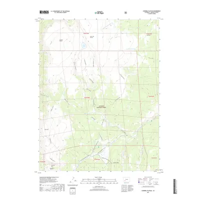
2019 Map of Cannibal Plateau
USGS Topo · Published 2019About this map
Slumgullion Earthflow and Slumgullion Slide dominate the southwestern corner of this high-altitude landscape, marking a massive active landslide that has shaped the drainage of the area. This portion of the Gunnison National Forest is defined by expansive flat-topped landforms like Cannibal Plateau and Calf Creek Plateau, which separate deep incisions such as Devils Canyon and the sharply named Cañon Infierno. These plateaus represent a unique volcanic geomorphology characteristic of the San Juan Mountains region.
Find a feature on this map
39 named features on this map. Tap any name to fly to it.
Don’t see what you’re looking for? This feature index may not catch every label — zoom into the map to look around manually.
Map Details
Editions of this 2019 Cannibal Plateau Map
This is the sole edition of this map. No revisions or reprints were ever made.
Other maps of this area

1903 · Lake City
USGS Topo · 1:62,500

1905 · Lake City
USGS Topo · 1:62,500

1905 · San Cristobal
USGS Topo · 1:125,000

1907 · San Cristobal
USGS Topo · 1:125,000

1908 · Uncompahgre
USGS Topo · 1:125,000

1911 · Uncompahgre
USGS Topo · 1:125,000

1945 · Durango
USGS Topo · 1:250,000

1953 · Durango
USGS Topo · 1:250,000

1954 · Durango
USGS Topo · 1:250,000

1956 · Montrose
USGS Topo · 1:250,000