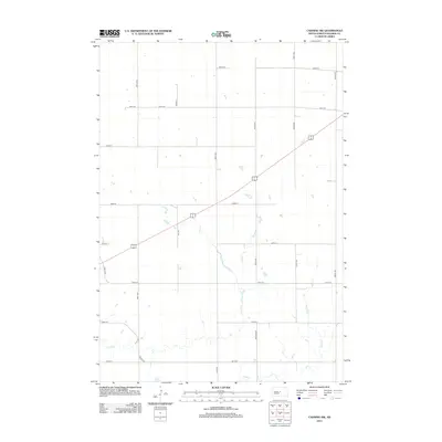
2012 Map of Canning NW
USGS Topo · Published 2012About this map
The seasonal waterways of Mush Cr and Dry Run define the drainage patterns of this Hughes County landscape. This 2012 survey shows a vast section of the South Dakota prairie structured by a rigid section-line road grid, including Nystrom Rd and Mush Pl. The corridor of 14 83 cuts diagonally across the northern half of the map, serving as the primary transportation artery through the region. This particular map is highly characteristic of the High Plains agricultural layout, where the natural terrain of winding creek beds contrasts sharply with the mathematical precision of the range and township surveying system. While the area is dominated by open land, local access points like Wood Pl and Co Hwy 652 provide the necessary infrastructure for rural life in this part of the state.
Find a feature on this map
22 named features on this map. Tap any name to fly to it.
Don’t see what you’re looking for? This feature index may not catch every label — zoom into the map to look around manually.
Map Details
Editions of this 2012 Canning NW Map
This is the sole edition of this map. No revisions or reprints were ever made.
Other maps of this area

1924 · Pierre
USGS Topo · 1:62,500

1934 · Canning
USGS Topo · 1:48,000

1937 · Canning
USGS Topo · 1:62,500

1954 · Pierre
USGS Topo · 1:250,000

1958 · Pierre
USGS Topo · 1:250,000

1967 · Pierre NE
USGS Topo · 1:24,000

1967 · Canning
USGS Topo · 1:24,000

1967 · Onida SE
USGS Topo · 1:24,000

1967 · Onida SW
USGS Topo · 1:24,000
1967 · Canning NW
USGS Topo · 1:24,000