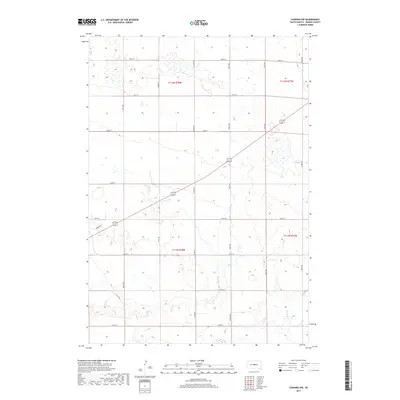
2017 Map of Canning NW
USGS Topo · Published 2017About this map
Dry Run and Mush Cr meander through this section of Hughes County, defining the drainage patterns of a landscape segmented by a precise grid of rural section roads. This 2017 survey by the U.S. Geological Survey captures the modern configuration of agricultural land and transit corridors northeast of the state capital. Local named roads such as Marble Rd, Nystrom Rd, and Wood Pl provide specific geographic markers for genealogists and local historians tracing family landholdings or property boundaries within the townships of T112N R78W and T111N R78W. The topographic detail illustrates the subtle elevation changes characteristic of the Missouri River plateau, where seasonal waterways like Dry Run have carved gentle depressions into the plains.
Find a feature on this map
24 named features on this map. Tap any name to fly to it.
Don’t see what you’re looking for? This feature index may not catch every label — zoom into the map to look around manually.
Map Details
Editions of this 2017 Canning NW Map
This is the sole edition of this map. No revisions or reprints were ever made.
Other maps of this area

1924 · Pierre
USGS Topo · 1:62,500

1934 · Canning
USGS Topo · 1:48,000

1937 · Canning
USGS Topo · 1:62,500

1954 · Pierre
USGS Topo · 1:250,000

1958 · Pierre
USGS Topo · 1:250,000

1967 · Pierre NE
USGS Topo · 1:24,000

1967 · Canning
USGS Topo · 1:24,000

1967 · Onida SE
USGS Topo · 1:24,000

1967 · Onida SW
USGS Topo · 1:24,000
1967 · Canning NW
USGS Topo · 1:24,000