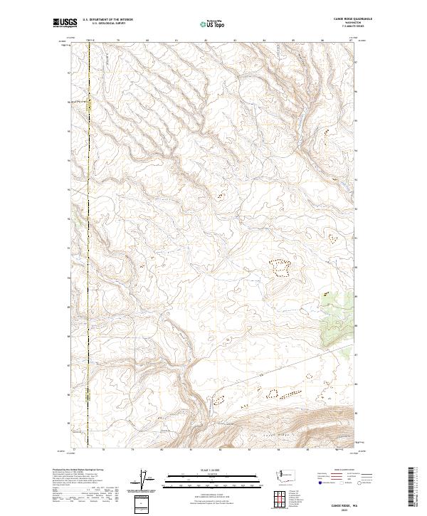
2023 Map of Canoe Ridge
USGS Topo · Published 2023About this map
Canoe Ridge defines the southern portion of this landscape, rising above a network of drainages that carve through the high plateau country of Benton and Klickitat counties. The terrain is marked by deep incisions such as Dead Canyon and Moore Canyon, which channel seasonal water toward the Columbia River corridor. The map reveals a specialized agricultural environment where large-scale operations are served by routes like 100 Circle Farms Rd and 100 Circle Ranch Rd, suggesting a modern ranching or farming infrastructure that respects the natural contours of the land. Moving toward the northeast, Glade Creek winds through the topography, followed by Glade Creek Rd. This survey documents a quiet interior of Washington state where the boundary between Klickitat and Benton counties intersects with a series of long-established range and township lines.
Find a feature on this map
15 named features on this map. Tap any name to fly to it.
Don’t see what you’re looking for? This feature index may not catch every label — zoom into the map to look around manually.
Map Details
Editions of this 2023 Canoe Ridge Map
This is the sole edition of this map. No revisions or reprints were ever made.
Other maps of this area

1906 · Blalock Island
USGS Topo · 1:125,000

1908 · Blalock Island
USGS Topo · 1:125,000

1915 · Prosser
USGS Topo · 1:125,000

1917 · Prosser
USGS Topo · 1:125,000

1953 · Pendleton
USGS Topo · 1:250,000

1953 · Walla Walla
USGS Topo · 1:250,000

1955 · Prosser SW
USGS Topo · 1:24,000

1956 · Pendleton
USGS Topo · 1:250,000

1958 · Walla Walla
USGS Topo · 1:250,000
1962 · Phinny Hill
USGS Topo · 1:24,000