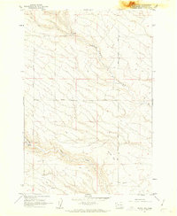
1962 Map of Phinny Hill
USGS Topo · Published 1963About this map
Phinny Hill rises as a prominent landmark in this 1960s study of the eastern Klickitat County landscape. The area is defined by the sharp incision of Dead Canyon, which cuts a deep northwest-to-southeast path across the terrain. Settlement patterns are evidenced primarily through a network of rural routes and specialized infrastructure, including Mercer Road, Peterson Road, and an established Pipeline traversing the southern sections.
Find a feature on this map
16 named features on this map. Tap any name to fly to it.
Don’t see what you’re looking for? This feature index may not catch every label — zoom into the map to look around manually.
Map Details
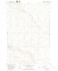
Editions of this 1962 Phinny Hill Map
2 editions found
Other maps of this area

1906 · Blalock Island
USGS Topo · 1:125,000

1908 · Blalock Island
USGS Topo · 1:125,000

1910 · Zillah
USGS Topo · 1:125,000

1915 · Prosser
USGS Topo · 1:125,000

1916 · Arlington
USGS Topo · 1:125,000

1917 · Prosser
USGS Topo · 1:125,000

1950 · Yakima
USGS Topo · 1:250,000

1953 · Pendleton
USGS Topo · 1:250,000

1953 · Walla Walla
USGS Topo · 1:250,000

1953 · The Dalles
USGS Topo · 1:250,000